| Drought in the West | A Photographic Essay |
Reno/Truckee Meadows
|
Next → |
Interactive Cartograph: Clickable place names, horizontally scrollable.
Donner Creek: 2.2015
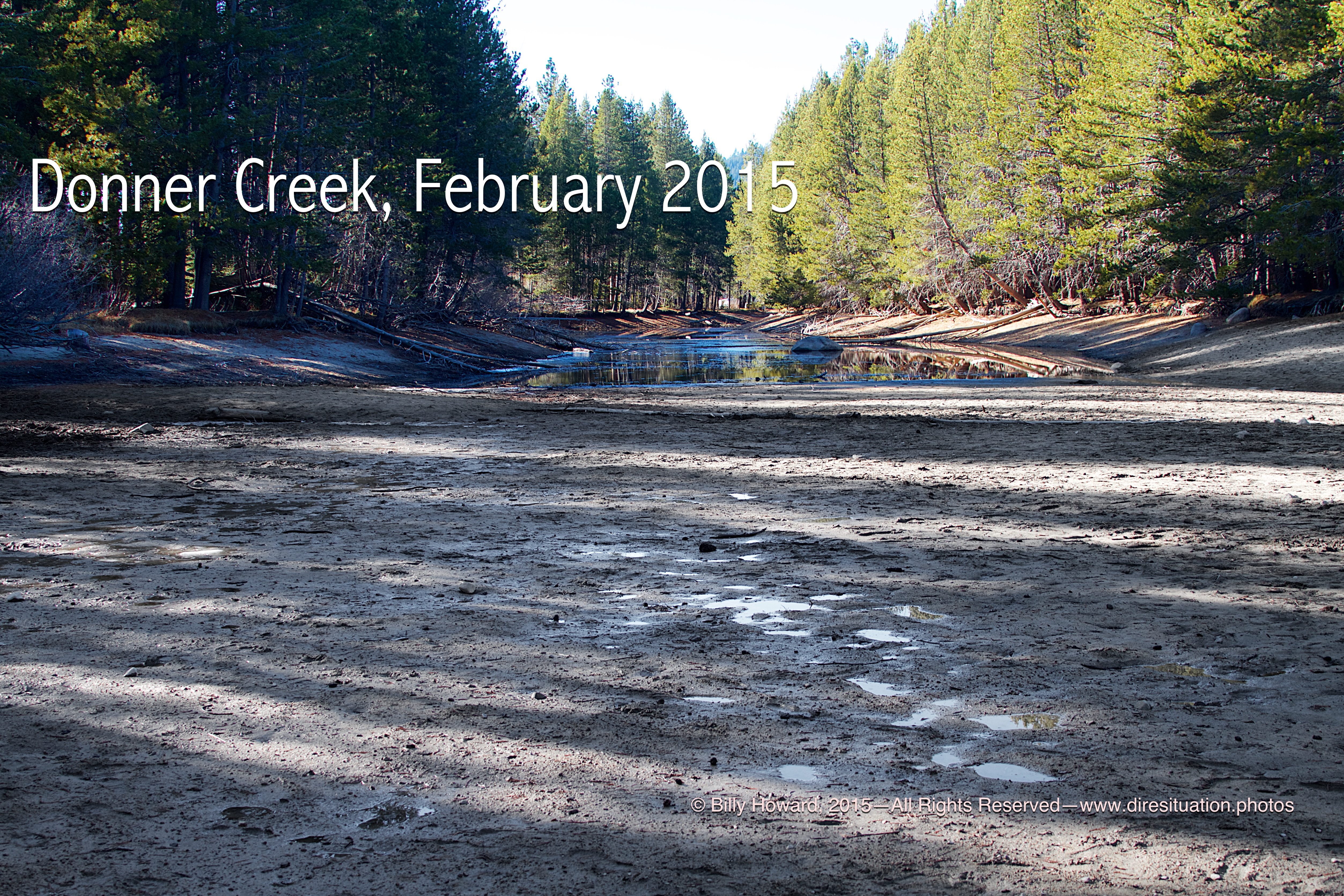
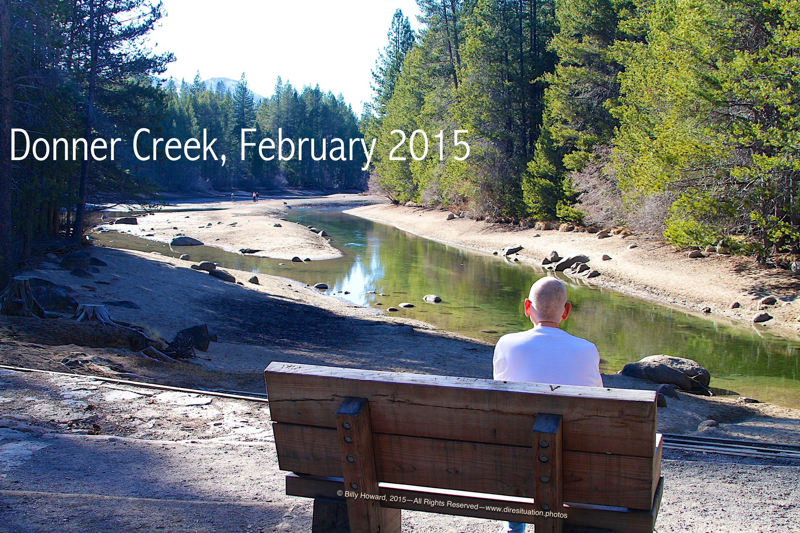
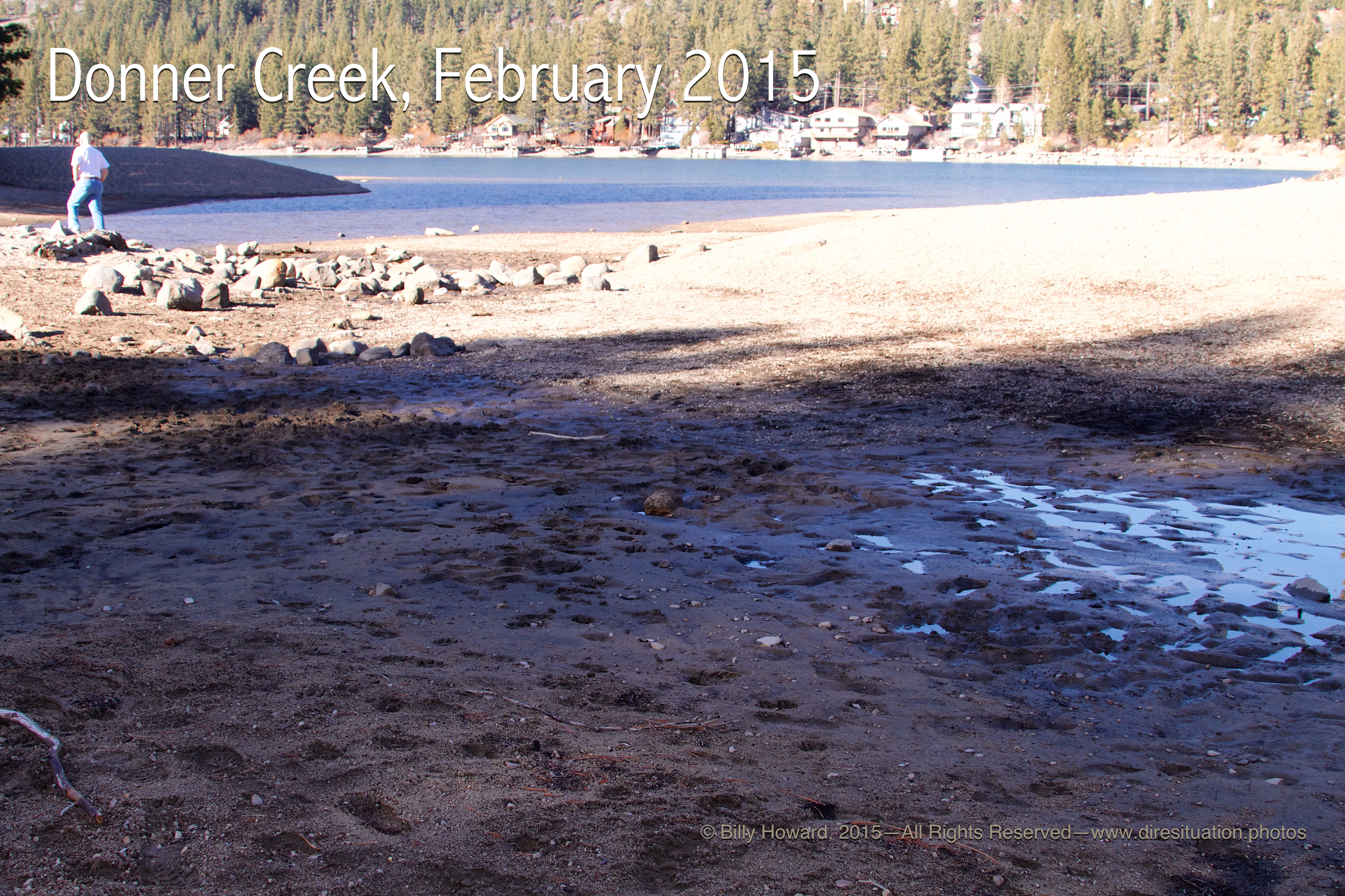
Donner Creek enters Donner Lake from the west and outflows to the east where it joins the Truckee River.
In these images taken on a warm and pleasant day in mid-Winter, February, 2015, the lake level is too low to spill into the creek.
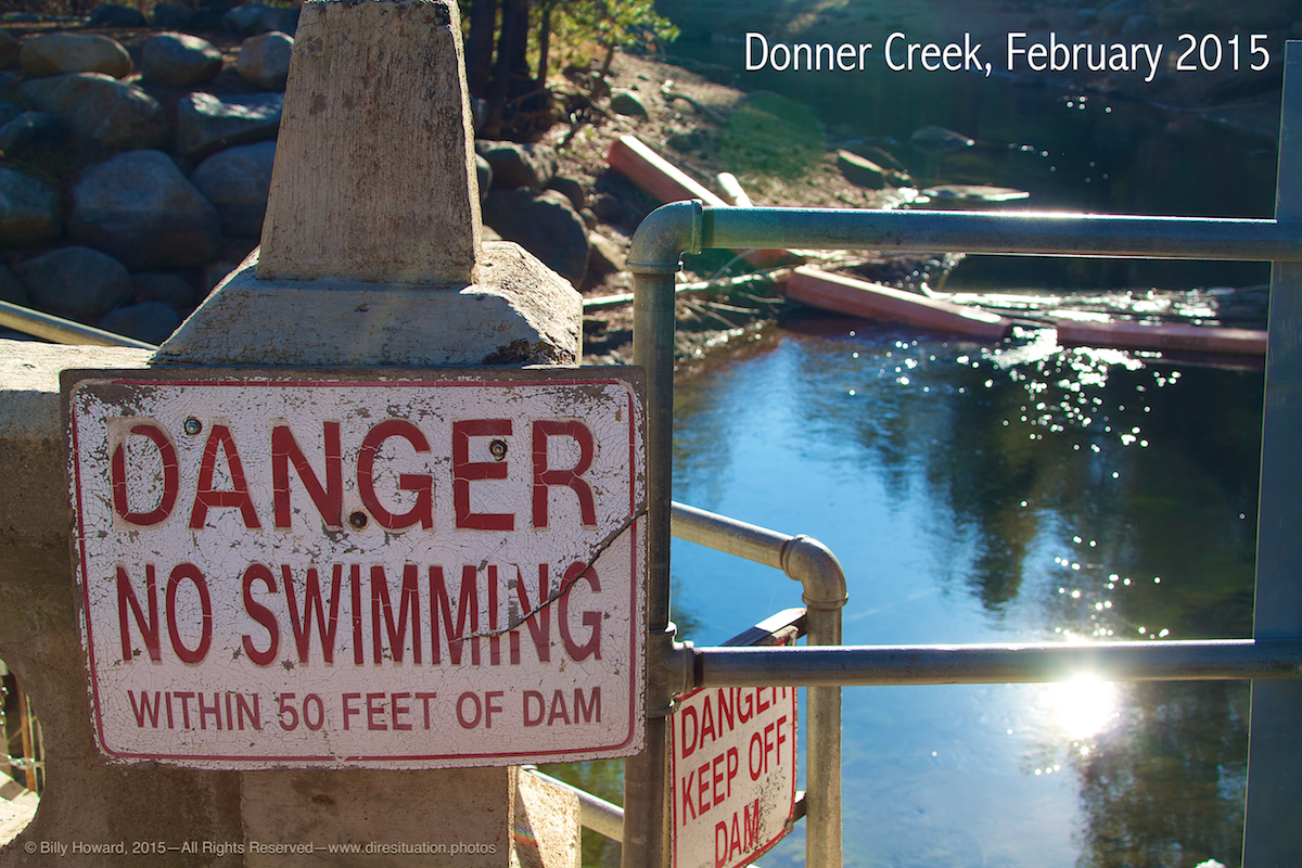
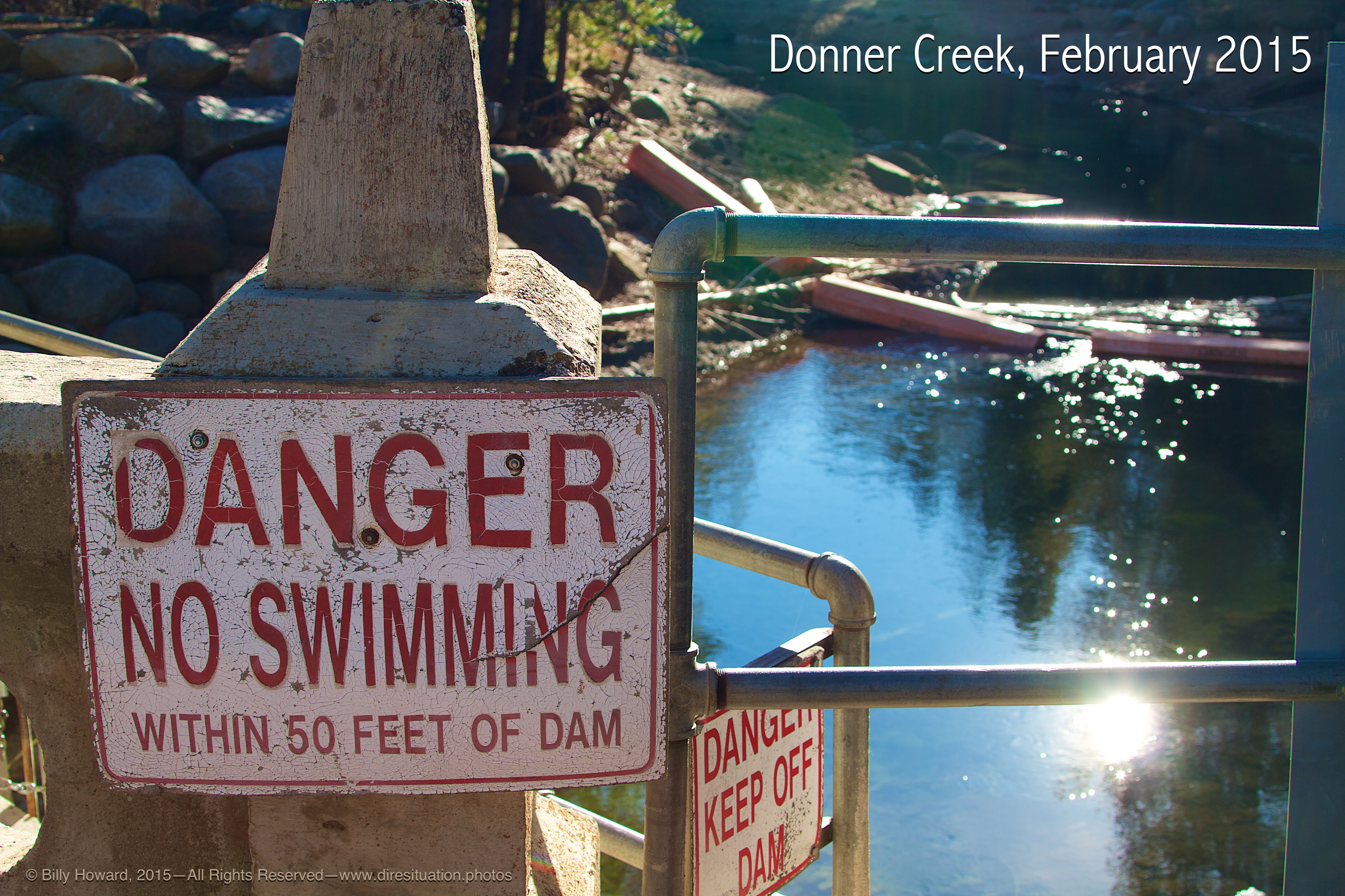
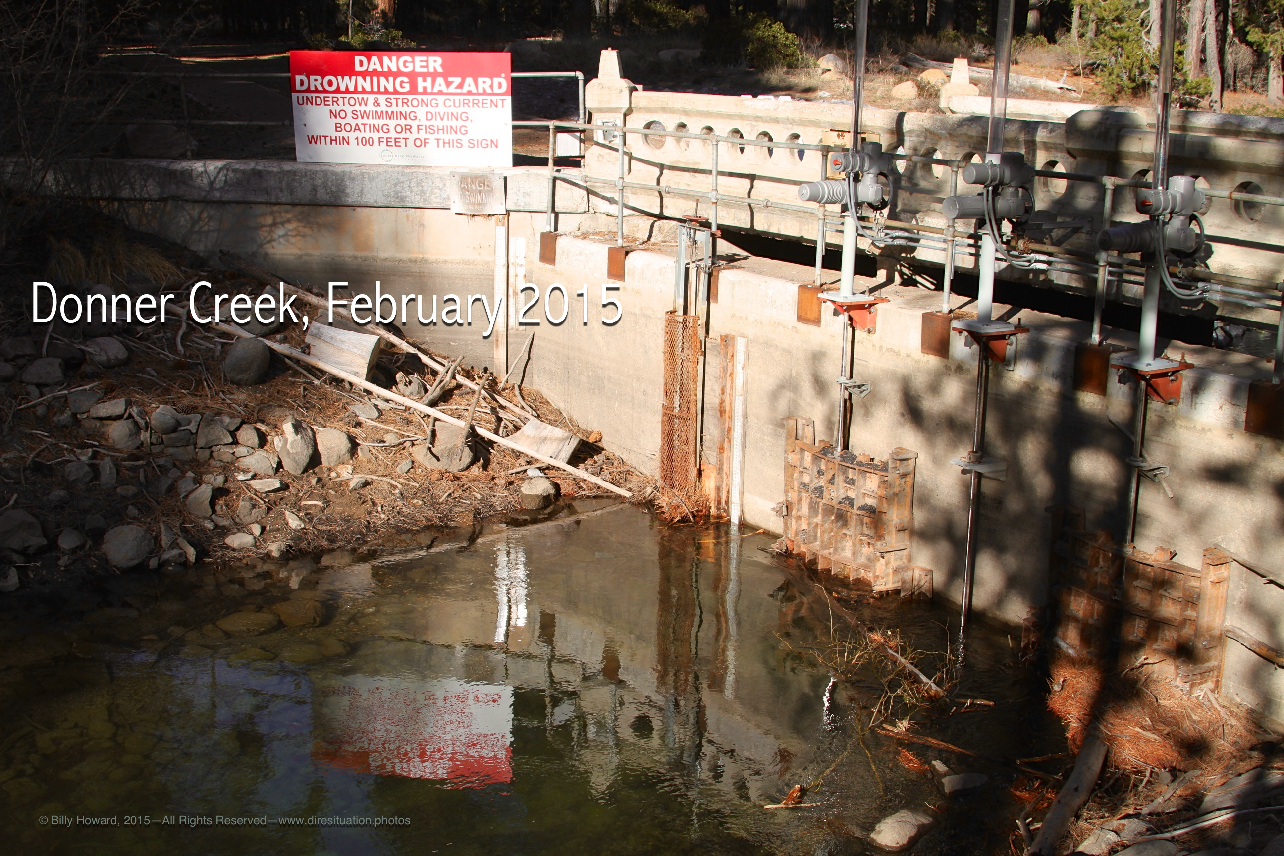
The "No Swimming" warning is moot in the shallow waters of the Donner Creek channel.
Donner Creek enters Donner Lake from the west and outflows to the east where it joins the Truckee River.
In these images taken on a warm and pleasant day in mid-Winter, February, 2015, the lake level is too low to spill into the creek.
The "No Swimming" warning is moot in the shallow waters of the Donner Creek channel.
All content, including images © Billy Howard, 2015. —All Rights Reserved— High resolution versions available upon request to witness@diresituation.photos. Larger.
Once an island, the creekbed is extending the shore across to the island which may become the new shoreline.
|
|
Normally a wide and full channel filled with snow in winter, the creekbed is drying up.
|
|
|
||
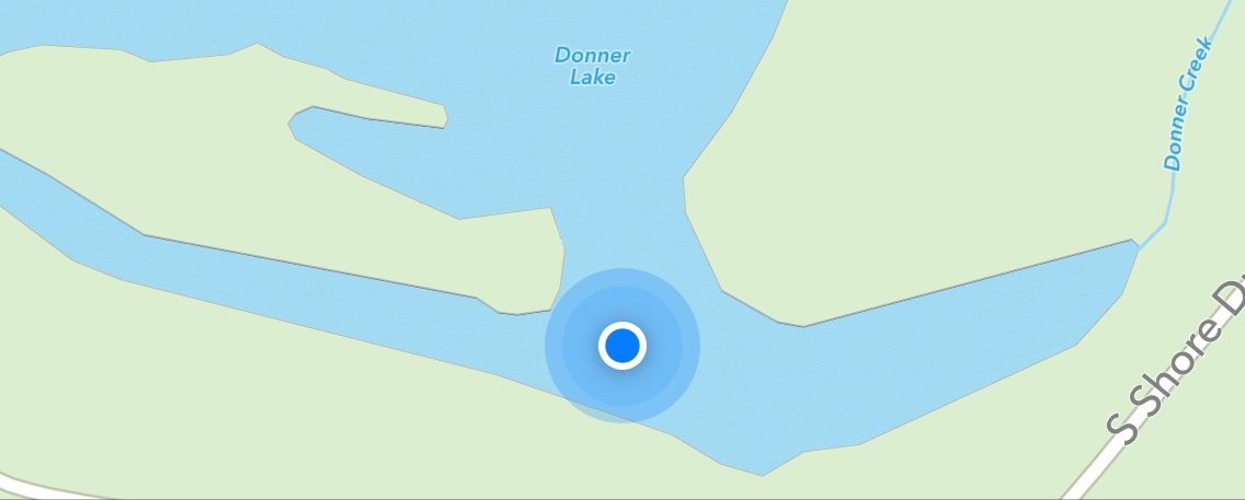
Spot shows where photographer was standing which was dry lake bed in Feb, 2015 as seen in photo below.
|
|
Satellite imagery for same location shows area underwater.
|
|
|
||
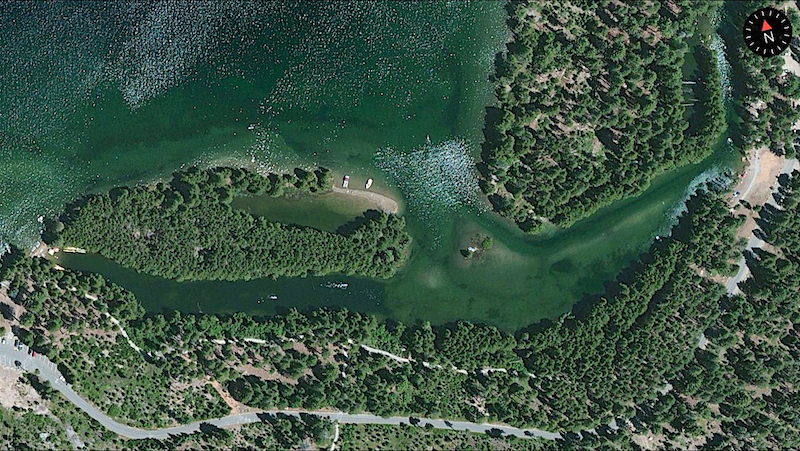
Photo of location where map screenshot was taken (above).
|
||
|
|
||
Dam on Donner Creek just west of the Donner Lake spill. Creek is very low against the gate for mid-winter.
|
|
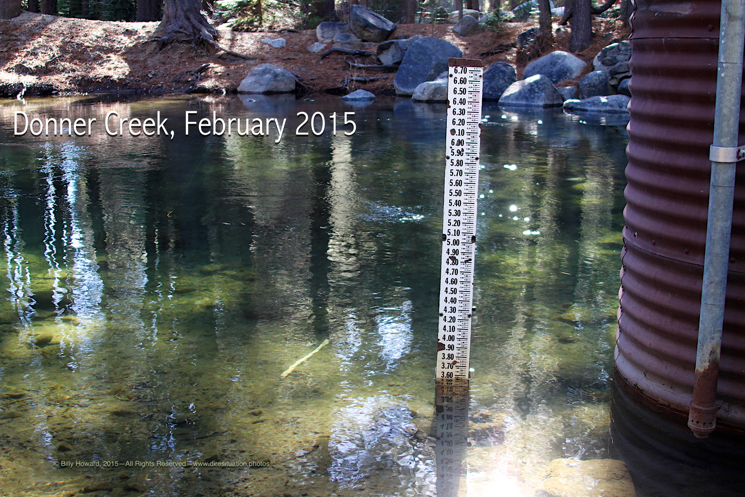
Gage on Donner Creek just west of the spillover from Donner Lake has a low reading in winter.
|
All content, including images © Billy Howard, 2015. —All Rights Reserved— High resolution versions available upon request to witness@diresituation.photos.